|
|
|

|
|
|
|
|
|
| Valenzano - Historical Photos |
| Streets |
| English | Italian | |||||
|
|
| Stazione Street | Valenzano 13 | |||||||||||||||||||||||||||||||||||||||
|
||||||||||||||||||||||||||||||||||||||||
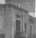
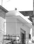
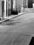
| Stazione St. in 1933. This street took its name initially from the railroad station at the end of the street in the picture. This road was renamed Roma St. in the 1950s, and renamed again Aldo Moro St. in the 1970s. This street has been one of the social and economic centers for the town in modern history. | ||||||||||||||||||||||||||||||||||||||||
| Stazione Street | Valenzano 24 | ||||||||||||||||||||
|
|||||||||||||||||||||
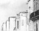
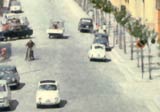
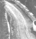
| Panoramic picture of Stazione St., from the beginning to the end at the railway station, taken around 1960. This short boulevard is host to the luminaries in August of every year for the celebration of the town patron saint, St. Rocco. | |||||||||||||||||||||
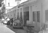
| Bari Street | Valenzano 15 | ||||||||||||||||||||||||||||||||||||
|
|||||||||||||||||||||||||||||||||||||
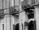
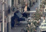
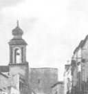
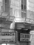
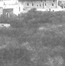
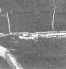
| Bari St. takes its name from the obvious fact that this is a key route from the heart of the town leading to Bari, the region government seat. This is a picture of the street looking away from Bari and toward the old town, with St. Rocco Church barely visible near the bell tower. The picture was taken from the intersection with Capurso St. around 1933. | |||||||||||||||||||||||||||||||||||||
| Bari Street | Valenzano 23 | ||||||||||||||||||||
|
|||||||||||||||||||||
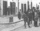
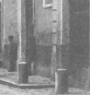
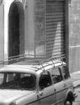
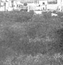
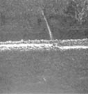
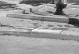
| A closer view of Bari St. looking toward the old town. Picture was taken around 1960. At this point, Bari St. yields to Stazione St. to the right. The small street straight up is the gateway to the old town when the town was protected by walls many centuries ago. | |||||||||||||||||||||
| Panoramic Picture | Valenzano 12 | |||||||||||||||||||
|
||||||||||||||||||||
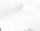
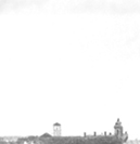
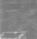
| Panoramic view of the town from the rooftop of a field house taken in 1933. Dirt road in foreground led to Santa Croce gateway, another gate in the old walled town. The original nucleus of the town was built around the castle and is visible on the left of the picture. This picture clearly shows the second nucleus as well, outside the town walls on the right side of the picture, which was started in the fifteenth century with the construction of St. Anthony's Church and a monastery. | ||||||||||||||||||||
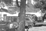
| Market | Valenzano 22 | ||||||||||||||||||||
|
|||||||||||||||||||||
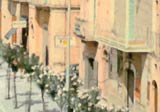
| Mercato Square, a corner of Plebiscito Square near St. Anthony Church. This area is known to many Valenzanoans as the "market". This is where produce vendors gather every morning to sell. The covered section on the right served both produce and seafood vendors, in separate sections. The market expands in the open square under the trees when there are extra vendors. The market swells to fill all of Plebiscito Square when merchants of all sorts join in every Friday.
Once a year, on November 1, the market swells to cover the whole town on an occasion known as "Fiera" (fair). Merchants come from far away regions in an event that is very old and steeped deep into history. |
|||||||||||||||||||||
| | Hist. Bldg | Old Monastery | Allsaints Ch. | Plebiscito Sq. | St. Anthony Ch. | St. Rocco Ch. | Streets | |
|
|
|
|
|